MNDF conducting hydrographic survey between Haa Dhaalu and Shaviyani atoll
The survey will be conducted by MNDF in association with the Indian Naval Hydrographic Office

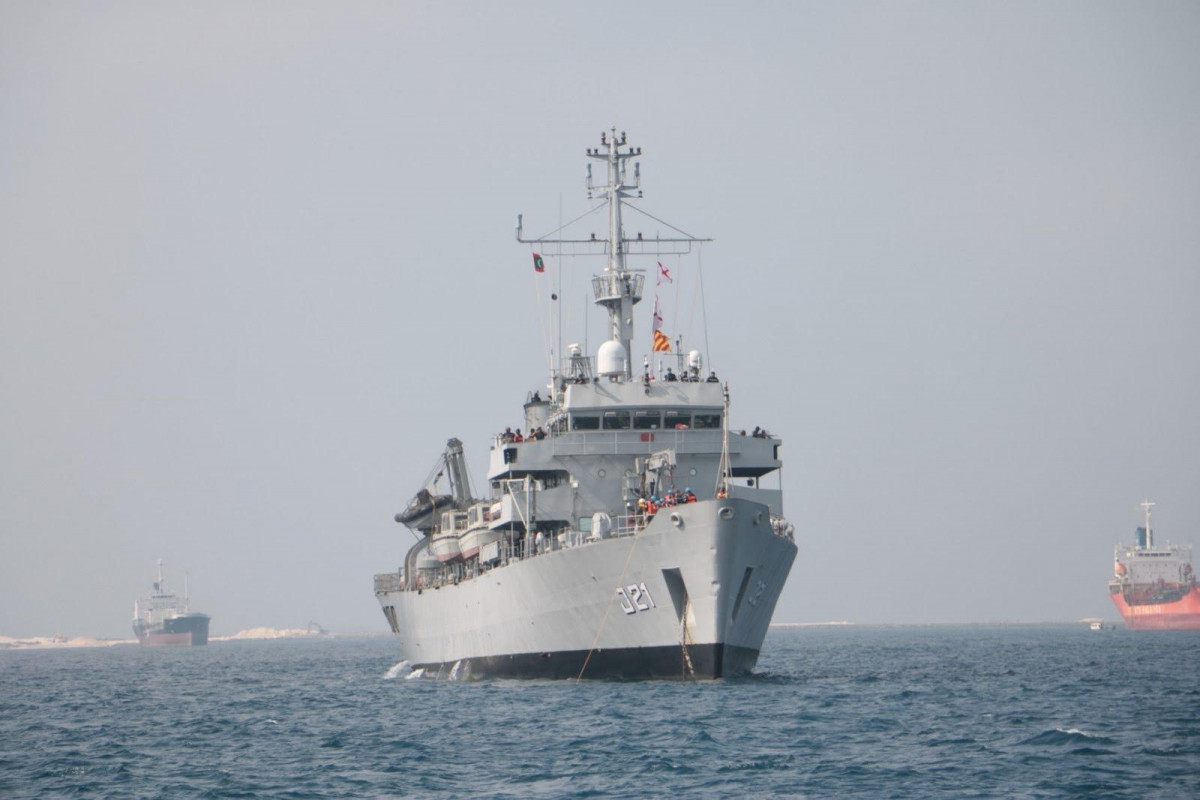
INS Darshak, a hydrographic survey ship from the Indian Navy, will be conducting phase I of the hydrographic survey between 31 Jan and 15 March
Maldives National Defense Force (MNDF) is collaborating with the Indian Naval Hydrographic Office to conduct a hydrographic survey between Haa Dhaalu and Shaviyani atoll, in a bid to upgrade the Maldives' navigation chart.
The INS Darshak, a hydrographic survey ship from the Indian Navy, arrived in the Maldives where it will conduct hydrographic surveillance in the region between Haa Dhaalu and Shaviyani atoll between 31 January and 15 March. According to MNDF, the survey, which aims to improve the safety of Maldivian seas for the benefit of travelers, will be conducted with full support from all the relevant authorities in the country.
Speaking at a press conference held in relation to the hydrographic survey, Commander of the MNDF Coast Guard Commander Colonel Mohamed Saleem said that the survey would not be collecting information that could jeopardize military operations or national security in the Maldives. He added that India was the regional coordinator for the South East Asia Region at the International Hydrographic Office, and that such surveys were always conducted by the most developed nation in different regions of the world for other countries within the same block.
Lieutenant Colonel Ahmed Latheef, Director at MNDF Coast Guard, answered a question by a member of the press, stating that the survey would not pose a threat to national security in any way, and that it would not involve collecting information that could undermine the Maldives' defenses.
The Indian Naval Hydrographic Office has been conducting hydrographic surveys in the Maldives since 2007. These surveys have upgrade to the latest version geographical charts, GPS and electronic charts used by Maldivian seafarers for navigation purposes, in addition to facilitating the production of acurate anchorage and approach charts as wewk. As such, a hydrographic survey can help drastically decrease the number of ships that run aground on reefs, one of the most common maritime accidents in the Maldives, to ensure the safety of travelers and prevent financial losses.
The survey is projected to help legalize insurance claims and further provide information critical for economic expansion, in addition to providing data on effects of climate change and information that can bolster critical coastal zone management efforts in Maldives.
The hydrographic survey will be conducted in phases, with the first phase taking place between 31 January and 15 March as the INS Darkshak surveys the region between Haa Dhaalu and Shaviyani toll. This phase will also include collecting data to create a large-scale approach chart for the HDh. Kulhudhuffushi International Seaport as well. As of now, large-scale approach charts have only been published for the Male' region, Addu atoll and Ihavandhippolhu in Haa Alif atoll.