SAARC Satellite set to take off on May 5th; Here's what Maldives will gain?
3 މެއި 2017 | ބުދަ 12:12India to launch communications satellite for SAARC on May 5

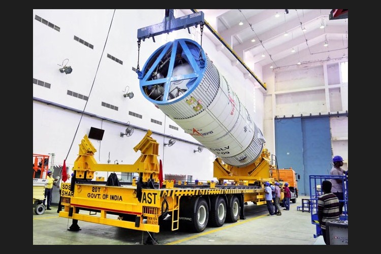
The second stage of the GSLV F09 during vehicle integration.
Prime Minister Narendra Modi's two-year-old promise of a satellite for SAARC nations will be fulfilled this week.
The Rs. 235-crore "South Asia Satellite", which will cater to seven nations, including Maldives, will take off from Sriharikota in Andhra Pradesh on May 5.
At the planning meeting on June 22, 2015, Pakistan decided to 'opt out' of the SAARC satellite suggesting that it had its "own space programme". Pakistan has five satellites but lacks heavy duty launchers and satellite fabrication facilities. Sources said Pakistan was not allowed to veto the project, which was renamed "South Asia Satellite".
Here are the top facts & what Maldives will gain from this giant project
- The 2,230-kg communication satellite, which Indian space research organisation ISRO calls GSAT-9, has been fabricated over three years. It would have cost the participating nations almost $1,500 million over its 12-year life.
- The government says the satellite will "enable a full range of services to neighbours".The areas will include telecommunication, television, direct-to-home(DTH),very small aperture terminals ( VSATs), tele-education and telemedicine.
- It can also provide secure hot-lines among the participating nations, which will be useful in case of management of disasters like earthquakes, cyclones, floods and tsunamis.
- The "South Asia Satellite" has 12 transponders -- devices for forming a communication channel with radio signals. Each nation will get access to at least one transponder, through which they could beam their own programming. Each nation has to develop its own ground infrastructure, but India is willing to extend assistance.
- It will provide real-time scientific data considering the fact that it will cover the entire SAARC region with a long coastline of around 12,000 kms. This will help in weather forecasting and preventing natural disasters considerably.
With input from NDTV/Agencis